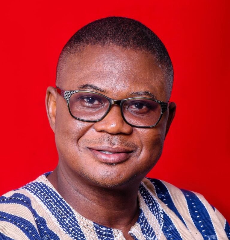

Isaac K. Mwinbelle, GGSA Director General

With the dust of a catastrophe still settling, the Ghana Geological Survey Authority (GGSA) says Ghana and Turkiye share earthquake history, drawing concerns about the mad rush on the part of the middleclass to scramble for lands in one of Accra’s residential areas prone to flooding and earthquakes.
Speaking during a sensitisation workshop for media personnel at the National Seismic Observatory at Achimota, the Director General of GGSA, Isaac K. Mwinbelle, recalled that the most destructive earthquakes that struck Ghana and caused a lot of damage, including loss of lives, occurred in 1939. He said the magnitude was 6.5 on the Richter scale.
The recent disaster in Turkey had over 55,000 people dead or missing, collapsing buildings and sending residents running into the streets. Its magnitude was 7.8-magnitude, reports indicate.
“We experienced our own December 12, last year, and when it happened, we were looking for where to find information. When it comes to issues of earthquakes, tsunamis, tremors, the GGSA is mandated to monitor those issues,” he stated.
The GGGSA Director General emphasised that earthquakes cannot be prevented, and can strike anywhere at any time, adding that it had been historically observed that they occur in the same general patterns.
Signals
Accordingly, the GGSA has warned that the series of tremor occurrences in parts of the country, especially in Greater Accra Region, over the years, is signal of a looming earthquake of greater magnitude in the future.
He cited the earthquake which happened in Accra on March 24, 2018, which measured 4.0 on the Richter. He recalled that on December 9, 2018, another one was experienced in Accra.
He said since 1915 and 1939, when Ghana experienced its severest earthquakes with a magnitude of over 6.0 on the Richter scale, there had been reported yearly occurrences of fleeting earth tremors.
According to the GGSA Director General, the Authority cannot predict earthquake occurrences, but rather forecast. He said signs picked up after earth tremors hit parts of Accra on March 24, 2018 showed that the fault lines were active, which meant that an earthquake could occur at any time.
On January 12, 2006, a tremor measuring 3.7 on the Richter scale hit parts of the capital, according to the Geological Survey Department. There was a similar tremor measuring 3.8 on the Richter scale in May 2003.
Mr Mwinbelle advised that the scenes of death and despair in Türkiye and Syria should also serve as an overdue reminder of the risks Ghana faces in ensuring that the country’s buildings are regulated.
He stressed the need for the district assemblies to take a cue by ensuring that earthquake-prone zones within localities are properly mapped out so that construction does not take place there.
GGSA mandate
He provided historical context which outlined the purpose and objective of the establishment of the GGSA.
He explained that following the passage of the Ghana Geological Survey Authority Act 2016 (Act 928) in 2016, it became Ghana Geological Survey Authority.
He also disclosed that the GGSA draws its existence and power from Act2016 (Act 928). He downplayed suggestions that the GGSA exists to undertake surveying activities in the mining sector alone, clarifying that the function of the GGSA encompasses providing advice to the government on all matters spelt out under Act 928.
He disclosed that for the GGSA to be effective with its work, it needs the collaboration of the media and relevant stakeholders to shape public opinion about its works.
Assurance
The Director General gave the assurance that the GGSA would continue to explore for additional minerals other than gold. He mentioned iron ore, limestone, clay, copper, lead, cobalt, zinc, lithium, columbite-tantalite, among others, as precious minerals that can be harnessed in supporting government’s development efforts as part of diversification of the mining industry.
He also stressed that the Authority would continuously monitor seismicity/earthquake, carry out geo-hazard assessment, public education and sensitisation on seismic hazards of the country to enhance capacity to reduce and mitigate the impact of natural disasters and risks.